Whether hiking the Appalachian Trail or trying to find Macy’s at the mall, where would we be without maps? Well … probably lost. Maps help locate us and get us from point A to B.
They’re perfect for presenting lots of information in one graphic image, and by definition maps must be functional. But do they have to be dull, confusing, number-laden sources of frustration? Of course they don’t. And nowhere that I know makes this point better than the David Rumsey Map Collection website.
Rumsey, one of the most enthusiastic and altruistic map collectors on the planet, has accumulated over 150,000 historical maps, 60,000 of which have been scanned and put online for free access at his excellent website. Not only are these high resolution maps available for review, but they can also be downloaded for personal, non-commercial use.
“Maps hold a clue to what makes us human. Certainly, they relate our history. They reflect our best and worst attributes – discovery and curiosity, conflict and destruction. Even as individuals, we seem to have a need to plot a path and track our progress, to imagine possibilities of exploration and escape.” —Simon Garfield, On the Map
I wouldn’t call myself a map geek (Terri begs to differ), but my professional training and years of travel have instilled a keen interest in historical maps. For me, a visit to Rumsey’s website is like walking into a dusty, old bookshop or an old-fashioned hardware store. I know there must something there I need, and it only takes a bit of poking around to find it.
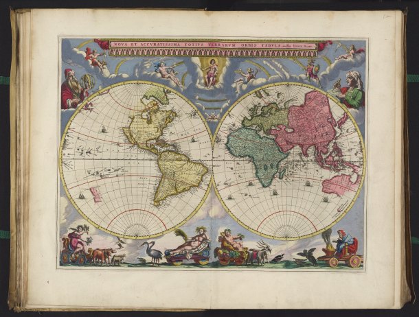
The scanned maps are very high resolution which makes it possible to zoom in for incredible detail and study.
The combination of rich detail, unbelievable variety and free online access, makes the website a marvelous trove for everyone – from the mildly curious to map wonks.
“They take the rustic murmur of their bourg,
For the great wave that echoes round the world.” —Tennyson
In his scholarly A History of the World in 12 Maps Jerry Brotton said, “Perhaps the best metaphorical description of maps was graffitied in 45-centimeter letters on a wall next to the railway line approaching Paddington Station in London:
“Far away is close at hand in images of elsewhere.”
“A metaphor, like a map, involves carrying something across from one place to another. Maps are always images of elsewhere, imaginatively transporting their viewers to faraway, unknown places, recreating distance in the palm of your hand. Consulting a world map ensures that faraway is always close at hand.”
If you have even a sliver of interest in historical maps, you owe it to yourself to visit this fun and informative website. But block out some time; you may be there a while.
Happy Trails,
James
Last Updated September 6, 2023
P.S. Google has teamed up with Rumsey and their joint Geogarage project has wonderful map overlays of old maps overlaid on present-day city maps. This is an interactive map of New York City in 1936. Try the cool slider in the upper right corner.

This is amazing! I love maps, my favorite being the ones I’ve used during a trip to a new city. It ends up folded in strange creases with notes here and there correcting this and that on the map for future uses. Sometimes I look back at them and I see an asterisk or a line and I wonder, what was that for? I go back through my pictures and see what landmark I was marking and sometimes it’s better than a picture or a journal entry because the wear and tear on the map gives me the impression of my trip. Great post. Thanks for sharing!
I’m happy to hear that someone else does this with their maps. We spent a month in Athens, and I had a map that was folded, re-folded, and so annotated that I had to use duct tape to hold it together. It had so much great info on it that I couldn’t replace it and start over. ~James
Charming, but no mention of Dismal Swamp can I find! 🙂
Au contraire Yvonne. Check the right upper section of this map, just on the Virginia side, just above Alligator Swamp. 🙂
http://www.davidrumsey.com/luna/servlet/detail/RUMSEY~8~1~1983~150019
~James
Hah! They’re the great pretenders, a faint shadow of the real Dismal Swamp.
Wow, I love maps.
How have I never found this site before!?
Thanks for the as usual, interesting tale! 🙂
Chris, I felt the same way when I found this site. BTW, I discovered the Rumsey collection in the book “Maphead” by Ken Jennings. This is an interesting, funny, and informative book about maps and their history that you might want to check out. ~James
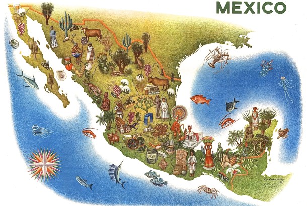
There are some cool maps in that section – thanks for sharing. If I had a real house, I’d put those on the wall. I really liked the one of Mexico.
FYI Jeff, I don’t know if you noticed, but you can buy prints of any of their maps, which I also think is fabulous. I’m considering framing a couple but haven’t decided which ones yet. ~James
There is some good stuff here. I always buy a postcard map when I travel.
I truly love this website Andrew. I had to control myself to avoid gushing while writing the post. BTW, be sure to try out the geogarage function. Check out this great overlay of an 1843 map over modern-day London.
http://rumsey.geogarage.com/maps/g0890184.html
And don’t miss the slider in the upper right corner.
~James
Beautiful maps! Love them!
Thanks Ina. FYI, I checked the collection and found a map of Croatia and the Balkans from 1570. This is just why I love this website and collection.
http://www.davidrumsey.com/luna/servlet/detail/RUMSEY~8~1~275304~90048461:-41–Schlavoniae,-Croatiae,-Carniae?sort=Pub_List_No_InitialSort%2CPub_Date%2CPub_List_No%2CSeries_No&qvq=q:croatia;sort:Pub_List_No_InitialSort%2CPub_Date%2CPub_List_No%2CSeries_No;lc:RUMSEY~8~1&mi=0&trs=92
~James
Wow! Thanks James, I will study it and wnjoy 🙂
Before I tour a town, I usually visit several map sites and I have 2 spiral bound state maps. Despite plotting the best route to maximize my coverage of a town, I almost always find myself frustrated at seasonal, closed or private roads. Even my GPS can send me on a goose chase! I’ve often thought google maps or mapquest should hire me to inform them of roads that “AREN’T”. I love the artistic flare of the old maps!
Laura, it’s obvious from these old maps that most of these early cartographers were also artists. In addition to the art, the political messages are interesting. I love going to old maps of cities that I know and seeing their growth over the years. And I’ve often wondered why GPS companies don’t have a program where users can submit mistakes and corrections. People like you would be a great resource. ~James
I love maps and these are really pretty!
I agree Meg. I guess that gone are the days of pretty maps, which is sad really. ~James
James I will confess I am a terrible map reader. The invention of GPS ranks right up there with that of Penicillin in my books. Without it I might be left for dead driving or walking about some foreign to me location. Having said that I like these more interesting maps. Like Jeff the one of Mexico is my top pick.
Sue, I agree. Without question, GPS technology is brilliant! Terri and I don’t argue over much, but in the pre-GPS days there were quite a few disputes in our car between driver/navigator. I also love GPS as an exploration tool. If I see something interesting, I always make a turn to check it out, because with GPS it’s almost impossible to get lost, and I can always get back on track. ~James
Like Sue, I am also a terrible map reader. I do however love looking at old maps and maps with pictures included! This looks like an amazing site. Thanks for bringing it to our attention.
Thanks Darlene. The wonderful thing about the Rumsey website is that there’s so much cool art there that you don’t have to be a maphead to enjoy it. ~James
These maps are amazing! Thanks for the tip on this website. We love maps, particularly Terry, so I see hours of enjoyment in our future. 🙂
I’m sure that you’ll both love it LuAnn. I find that with all the variety, it’s very easy to get sidetracked. I’ll be looking for one thing, stumble into a cool map on a totally different topic, and off I go. It’s truly an interesting, useful, and astounding collection. ~James
Terry says that is how my mind works. I start a story, get sidetracked, and end up somewhere completely different. 😉
Have been AAA member for decades – for the maps, not the road side service although that has helped too.
Found in the UK, the GPS frequently got you from point A to B but over roads that would have been better avoided.
Thanks for the comment and for dropping by the blog. GPS is truly a technological marvel that has made a huge difference in our lives. But having said that, I still find there are times when I question a route and look at a paper map. Terri’s question is: “James are you arguing with the GPS?” ~James
Thank you! I can’t wait to use this site with my class this year. I love maps, but it’s nearly impossible to generate enthusiasm from 5th graders with the old roll down wall map that I’ve drawn all over!
Love to you both!
Thanks Anita. I’m so glad you can use this wonderful website. I’m sure that for a clever teacher like you it will be a goldmine for cool and interesting stuff. And with a little slight of hand, the kids might even learn something – even 5th graders. Love to all the Indy crowd as well. ~James
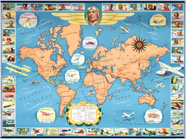
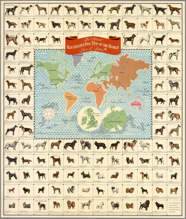
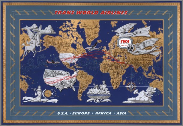
And just like that, David Rumsey’s collection shall be the black hole into which my productivity will be sucked! Thank you, James! 😉 These are all so fascinating (especially the dog map of the world), and I could spend hours dissecting the ones you’ve shared in the post. We have a standard world map up in our house, and even that relatively dull map has held me for many an afternoon… every time I look at a map, I feel like I learn something new. Thank you for the informative share!
Miranda, I’m not the least bit surprised that you enjoy maps (bless your heart), and I promise that this website will be a goldmine. The only problem that I have with this collection is staying on task. I have an idea and in my search I stumble onto something really cool and interesting, and off I go. But, this is a good problem to have. I’m surprised that the collection hasn’t gotten more notice, and I hope that my post will help in a very small way. ~James
Thank you so much – Id never heard of this site before. I’d been spending my time with a map of Middle Earth lately, and some of these are as fun and fictional as that!
Thanks Susan. One of the cool things about the Rumsey collection and website is that you can get as serious and academic as you want, or as fun and fictional. When I discovered this site, I just knew that our ramblin’ readers had to know about it. ~James
Great idea for a post! I love old maps. I only wish I could afford to hang nice ones on my wall!
In my efforts to lead a downsized and simplified lifestyle I’ve deliberately avoided collecting anything. But, if I were a collector, old maps would be at the top of my list. I particularly like old city maps of places I’ve lived. BTW, the Rumsey website sells prints of their maps and the prices aren’t too bad. ~James
Thanks for the info. I will check it out! I remember visiting an antique map store in Napa once and was blown away by the prices. But they were real and not reproduced.
Where would we be without maps? I spend an awful lot of time poring over satelite maps both before and after my walks. Plotting routes, working out where I went wrong and got lost, checking distances and the relationships between landmarks. None of this is possible down on the ground. Those beautiful old maps go a step further though, turning a tool into an art form.
Well said Marie, well said. I could pull this comment out and put it right in the middle of this post, and it would be perfect. When I wander, whether at home or abroad, I feel almost naked and helpless without some sort of map. There are small villages where getting lost is fun, but a map in my pocket ensures that I can always find my way again. ~James
Thanks for this link! You’re right. I’ve already gobbled up some time looking at these fabulous maps, and haven’t scratched the surface. I also love old maps framed as art — and booths at antique shows with these old gems are some of my favorites. Great idea for a post!
Thanks Rusha. As I said to someone else, I’m not a collector, but if I collected anything, it would be maps. Any kind of old map is interesting to me, because they show not only changes in the place but also changes in our state of knowledge and our perceptions of ourselves and others. And even though maps must be accurate, ultimately they are subjective in design. Very interesting. ~James
I love maps – these are great!
Thanks Pam. There’s lots of wonderful stuff here, and given time, it will be a new time waster for you. ~James
I could get very engrossed in a collection like this. I don’t think I dare even stick my nose tip in that website! But then again… 🙂
Jo, the amazing thing about this collection is its depth and variety. Every time I visit, I stumble on yet another delightful and interesting surprise. I especially enjoy the overlay of old maps on new maps. A truly unique collection and website. In my view, Rumsey should be knighted. ~James
You should propose it, sir! 🙂